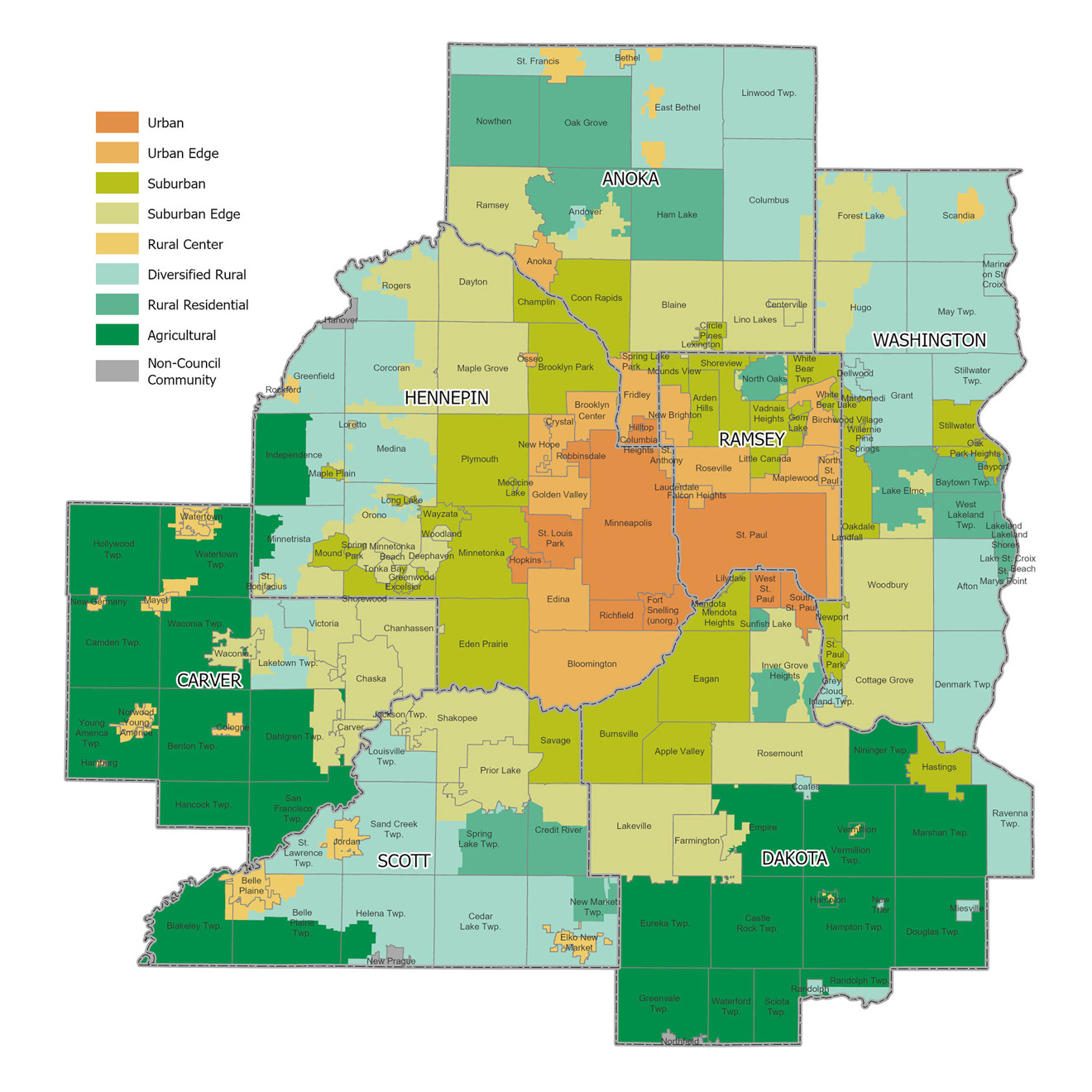
Community designations
Recognizing the variety of landscapes, in local jurisdictions and across the region, the Met Council sets the strategic direction using community designations and regional land use policies to accommodate regional forecasted growth, respond to development trends, and adapt the regional planning landscape to current challenges. These community designations continue the longstanding history of distinguishing between the Urban and Rural Service Areas while adding policy guidance to form the geographic planning areas that will guide the orderly and economical development of the region. Imagine 2050 builds upon the foundation of community designations by categorizing cities and townships based on defining characteristics essential for effective regional planning (see Figure 2).
As part of the regional development guide, community designations work in concert with land use policies to guide growth in areas with urban infrastructure; establish distinct land use policies and density expectations; protect agricultural land and natural amenities; and outline strategies to meet the region’s forecasted growth. Community designations are further used to plan and implement regional policies at the local level.
The Met Council assigns a community designation to each city and township based on the prevailing characteristics. Cities and townships along the developing edge of the region may have more than one community designation based on forecasted growth and current or planned development patterns. For example, an area of a township under an orderly annexation agreement with an adjacent Suburban Edge community would be assigned a Suburban Edge community designation or a township may be split between Rural Residential and Diversified Rural designations based on the existing development pattern. This designation indicates the overall state of current and anticipated development and regional issues faced by that city or township.
Community designations are also used to guide growth and development to areas that have urban infrastructure in place and capacity to accommodate development or redevelopment, to establish land use and density expectations for different planning areas, and to outline the roles of the Met Council and the individual local governments. Land use policy sets overall densities, by community designation, that planned development patterns of a city or township can be expected to achieve, along with planning considerations that local governments should incorporate into their planning processes.
Regional land use policies are framed around common characteristics of different jurisdictions. These common characteristics are the basis for community designations. These community designations are informed by key variables that guide development toward areas equipped with the necessary urban infrastructure to support forecasted growth.
Key variables used to define community designations include:
- Age of infrastructure: Acts as a proxy for the infrastructure’s overall condition and anticipated service life.
- Planned residential density: Extracted from 2040 local comprehensive plans; this variable helps in anticipating future growth patterns.
- Intersection density: Serves as an indicator of connectivity, urban form, and accessibility within the city or township.
By incorporating these main variables, Imagine 2050’s designations are tailored to implement regional policies effectively at the local level, accommodating projected growth with structure and foresight. Community designations not only support the planning of local policies but also help implement these strategies effectively, accommodating the region’s projected growth in a sustainable and efficient manner.
Community Designations Descriptions
Figure 2.1 2050 Community Designations